|
|
Location:
The island of Tenerife is located in the Atlantic ocean, several hundred kilometres west of Morocco; it is part of the Canary Island chain (a Spanish territory). This triangular-shaped island is 75km (50mi) long and 50km (30mi) wide, with an area of 2034 km² (786 mi²).
Geography:
Tenerife possesses a very dynamic landscape: undulating, mountainous terrain; picturesque old Spanish villages; terraced farmlands; native pine forests; sea-side cliffs; and high-altitude, volcanic rocky plateaus. Tenerife has the highest peak of all the islands, Mt Teide, which reaches 3718m (12,200 ft). Mt. Teide is also the highest point in Spain. In fact, this is the 3rd highest island volcano in the world. Good quality roads ascend up to 2300m!
Three islands in one:
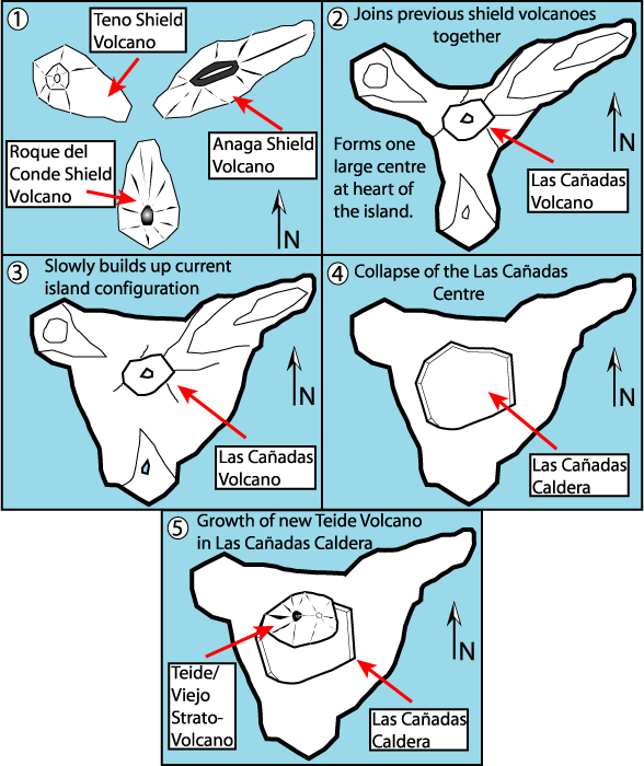
A few hundred thousands years ago, Tenerife was actually three seperate islands. With subsequent lava flows and volcanic upheavals, the dominant central Teide volcano joined together with both the Teno and the Anaga mountain ranges at its extremity, forming a single landmass. Even today, these other parts of the island “feel” like different places, because of their significantly different landscape.
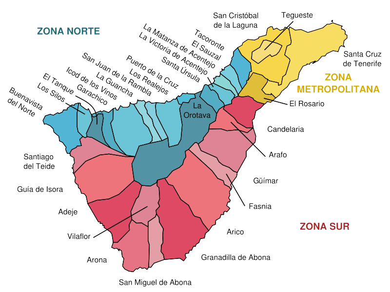
North vs South:
Due to Tenerife’s topography, the landscape is suprisingly varied; Tenerife can be roughly divided into two or three different zones. For one thing, you might notice that the Northern side of Tenerife is much greener than the South. It’s no secret that wherever there are mountains, you can expect clouds at various heights. The steep terrain found in the North of this island will often trap layers of status clouds, forming a “sea of clouds” phenomenon. Above this layer, you can expect 100% sunny blue skies (well, most of the time). The South tends to be hotter and sunnier than the North; the vegetation found in the South of Tenerife has also evolved to cope with a more arid climate. |